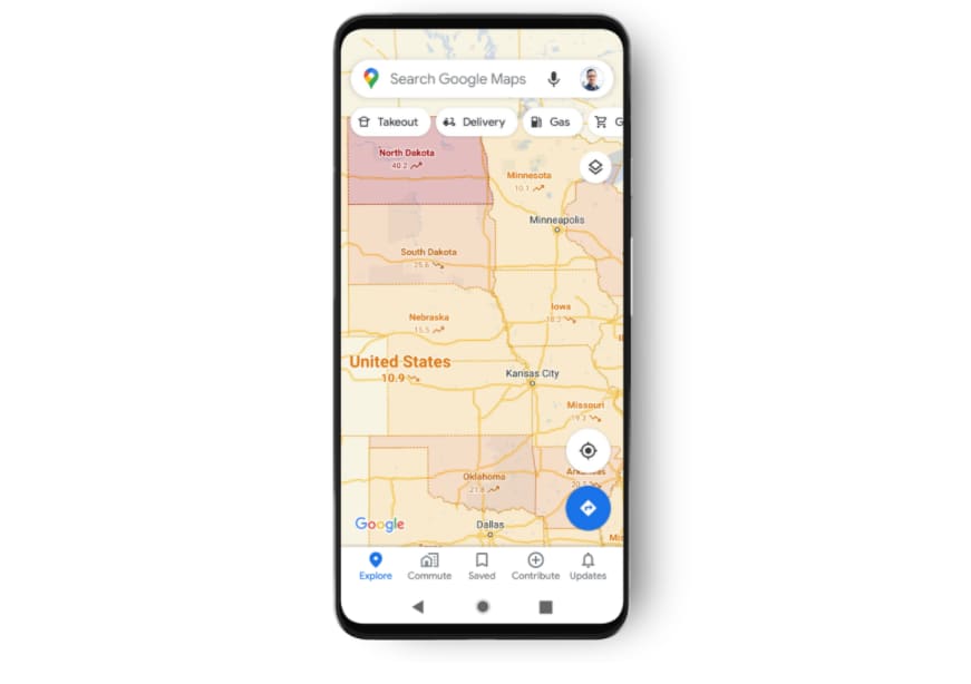
Google Maps Covid-19 overlay
Google on Wednesday announced a new feature in Google Maps that will show you how many Covid-19 cases there are in particular geographic regions. It pulls in information from Johns Hopkins, the New York Times, and Wikipedia and displays a color-coded map with the seven-day average of new cases per 100,000 people in a specific area. It will work in 220 countries and territories.
This means you can open Google Maps to see outbreaks in your area, which could be helpful if the disease spreads more rapidly in the fall and winter. You can also use it to see if there might be an outbreak brewing in a particular area before you make holiday travel plans.
Google Maps Covid-19 layer
The feature is rolling out for iPhones and Android phones this week. That means you might not see it today, but you should in the coming days. Just keep looking for a Google Maps update.
How to use Google Maps to track Covid-19
Google Maps Covid-19 layer
Once you get the update, you’ll be able to use the new feature by doing this:
- Open Google Maps.
- Tap the layers button, which looks like a square on top of another square.
- Choose the “Covid-19 Info” layer.
- Now you’ll see a map of cases around the world, color-coded by severity.